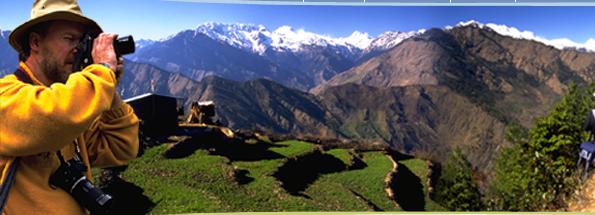
| The Annapurna region
lies towards the north of Central Nepal. The region
has been recognized as one of the world's best trekking
trails according to a recent survey by Modern Maturity
(USA). The highlight of this part of Nepal are Annapurna
peaks, Mt. Dhaulagiri, River Kali Gandaki and several
other peaks, Gateway to Annapurna trekking region is
the famous city of Pokhara. The most prominent ethnic
groups of Annapurna region are Gurung, Thakali and Manangba.
Animals found here are pica, blue sheep and Himalayan
Thar and vegetation ranges from tropical species to
temperate forest to oak, beech and rhododendron.
The popular trekking routes of this
region are Jomsom, Annapurna Circuit and Annapurna Base
Camp, Annapurna foothills, Sikles, Lamjung, Dhaulagiri,
Upper Mustang and around Pokhara. The best time to visit
is during spring and autumn. Unlike other parts of Nepal,
even the monsoon months.
Permits and Fees
For most of the Annapurna trekking area,
no trekking permits are required. The exception is upper
Mustang where a fee of US$700 per person is levied for
a ten-day visit. Additional restrictions relating to
Mustang will be outlined later.
Most of the area discussed in the trek
descriptions is within the area controlled by Annapurna
Conservation Area Project. Entry to this area is controlled
and an entry permit has to be purchased. The permit
must be purchased before starting the trek and can be
obtained in Kathmandu or Pokhara. The proceeds of these
fees are largely used for the local community development
within the project area.
Flora and Fauna
The flora and fauna to be seen are quite
diverse since the region ranges in altitude from less
than 200 meters above sea level at Jiri to the high
peaks of the Himalayan at over 8000 meters. Up to 4000
meters you will find dense stands of forest including
pine, cak and the spectacular flowering rhododendrons.
The latter are one reason to make a trip to Nepal in
the spring when the hills between 2000 and 3500 meters
are a rich of cultures.
The crops under cultivation will depend
on the season that you visit but expect to see wheat,
barley, corn and potatoes at some stage. Domesticated
animals will range from cattle, buffalo, goats and pigs
to the all-purpose beast of the mountains the yak.
There is a good chance of seeing wildlife,
mostly birds including the national bird of Nepal-the
Impeyan Pheasant, or Danfe, which is quite common around
Namche Bazaar. Other notable birds will include the
ravens and crows of the middle hills and the choughs,
which soar to seemingly impossible heights in the mountains.
Also in the mountains look for flocks of snow pigeons
wheeling around the hillsides.
Land animals can be more elusive but look
out for mountain goats (most commonly the Himalayan
Tahr) and if you are lucky, musk deer or barking deer
in the forests.
Getting there
Regardless of the trek chosen it is most
likely that Pokhara will be either the starting or ending
point of your trek. Pokhara is located 200 km. West
of Kathmandu and can be reached by road travel there
are a number of tourist buses available daily both from
Kathmandu and from Chitwan.
There is no shortage of tourist facilities
of be found in and around Pokhara. The main centre for
tourists is at the side of the largest of the three
lakes in the area, Phewa Tal. The suburbs agencies and
suppliers of souvenirs and trekking equipment. For those
trekking in the eastern side of the Annapurna massif
the most likely starting point will be Besishahar, the
district headquarters of Lamjung district. Buses from
Kathmandu. Pokhara and the Terai arrive and depart here
on a regular daily basis. The bus trip from Kathmandu
to Besishahar takes around four to five hours but, at
this time, there are no tourist bus services available.
Most treks starting or ending in
Pokhara will require the use of buses or hired cars
to reach the trailheads. Specific details appear in
the trek descriptions.
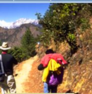
Trekking styles
Most of the trekking routes in the Annapurna
region are well serviced by teahouses for most of their
length. This is particularly true for most popular treks-the
Jomsom trek, the Annapurna circuit and Annapurna base
camp treks.
Trekkers should be aware, however that
there is always the risk of being stranded by bad weather
or injury/sickness between teahouses, particularly in
the more remote parts of the trek itineraries. a good
example is on the Annapurna circuit where there is one
very long day when the high pass of Thorong La has to
be crossed. There is little or no shelter available
for most of this day and some trekkers have been caught
unprepared by bad weather and altitude problems.
The treks in less developed areas, particularly
the Dhaulagiri circuit and the trek east of Lamjung,
definitely require trekkers to be self sufficient in
food and shelter.
Attraction-People and culture
The most prominent ethnic groups in the
Annapurna region are the Gurung, the Thakali and the
Manangba. The Gurungs are the most widely distributed
being found from the hills of Gorkha district to as
far west as Palpa. Their heartland, however, is center
on the hills and valleys between the Marsyangdi River
and the Kali Gandaki. The Thakali come from the upper
Kali Gandaki valley around where their traditional farming
has been supplemented by trade and, in particular, hotel
and restaurant business. The Mananagba are found in
the upper reaches of the Marsyangdi River and are in
many ways similar to the Gurung to whom they are possibly
related. They are skilled traders and trace their roots
back to Tibet. Religiously, the Manangba and the Gurungs
of the upper hills is Buddhist with traces of their
ancient, Shamanistic faith still apparent. The communities
that live further south are predominantly Hindu.
All of the communities, but particularly
the Gurungs, are famed for their cultural performances,
which are easily seen while trekking in the region.
Many villages along the trails will arrange performances
for trekkers during main seasons.
When to visit?
The peak seasons of October/November and
March/May are obviously the most popular. At these times
the weather is mild and generally dry, making the walking
conditions good. The spring season is good for wildflowers,
particularly the rhododendrons, while the autumn season
generally gives the best mountain views, as the air
at this time is crystal clear.
Winter is possible but the chances
of snow are higher and passes may be closed, particularly
during late winter. Also during this time many of the
teahouses will close.
Looking after the environment
Much has been said about the deteriorating
environment of the Himalaya. Over that past few years,
however, due to efforts by many overseas expeditions
and organizations such a the Sagarmatha Pollution Control
Committee and the Nepal Mountaineering Association,
education programmes and clean-up campaigns have to
a large extent, solved many of the problems.
Having said that, the environment
of the high Himalayan is a very fragile eco-system that
is easily put out of balance. The locals lived for generations
in relative harmony with their surroundings but the
recent influx of tourists has put pressure on the indigenous
population to supply more and more services in the name
of tourism development. While the Everest National Park
is somewhat protected from the worst of the ravages
the same cannot be said about the area immediately to
the south. Here, uncontrolled timber collection for
fuel and building has led to a marked loss of timber
cover. Certain initiatives within the National Park
area, such as the banning of glass beer and soft drink
bottles, had resulted in a reduction of the amount of
non-bridgeable rubbish being left behind. Particularly
the trekkers themselves can do much more, however. The
KEEP code of trekking conduct is a perfect example (see
Conservation Codes and Environmental Guideline.)
|